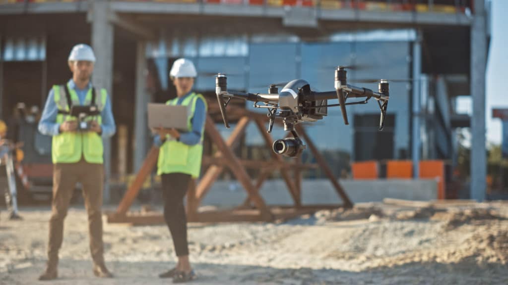

Drones are becoming more and more common in many sectors of the economy as they guarantee the fastest and most accurate collection of detailed data. This technology, which is developing at a very fast pace, means that drones have been used for increasingly complex tasks. They have become a crucial tool for the efficient work that survey technicians and engineers conduct.
Drones effectively support their projects in the matter of:
- Site Reconnaissance
- Roadway Assessment
- Culvert/Bridge Inspections
- Streambank/Steep Slope Access
- Park and Open Space Aerial Imagery
- Water Tank/Standpipe Inspection
- Building/Roof Inspection
- Treatment Plants
- Orthophotography
- Terrain Modeling
- 3D Mapping
- Construction Inspection
Drones Usage in Structural Engineering

Drones play a big part in the support of the structural engineering industry. They are often used to carry out a project or inspection during construction in hard-to-reach areas. Structural engineers use the advantage of the UAV to collect high-resolution photos, enabling a precise assessment of the existing condition of the roof, skylights, as well as culverts and bridges.
This technology is able to obtain a visual record more efficiently, faster, and safer for personnel. The camera may show damage, cracks, or deficiencies in buildings, reaching even the most difficult-to-reach locations of a structure.
Drones are great for documenting the condition of the structures before the planned renovation or rehabilitation, to which the owners get visual documentation of existing conditions. For instance, their application in bridge inspections holds quite an importance. If there is a need to scan a bridge, entailing highly detailed information, drones get it done easier than ever before. They not only create an incredibly accurate visual representation of a bridge but also shorten its inspection time. They are structurally similar to helicopters, with several propellers. They have a limited range and speed, but high maneuverability and the ability to reach difficult locations. It’s a great option for bridge inspectors to obtain photos or videos of areas difficult to access.
Drones Usage in Surveying

The use of drones is especially useful when the surveyor has to deal with an area difficult to access such as wetland, swampy, densely forested, or steeply sloped areas. In such a case, working with a drone is much more efficient. It only requires a drone operator with the appropriate license to operate the drone.
There is no need for human operators to physically measure points in hazardous locations. In addition to the increased safety advantages, drone usage becomes a financially beneficial option when compared to traditional topographic surveying, which is a labor-intensive process. The drone expedites this process, is more cost-effective, and decreases complications over difficult terrain.
With a properly equipped drone, survey technicians can obtain a set of data points in space, also known as point clouds. With the advanced software, they can take these data points and create a three-dimensional model of the terrain with the textures applied to individual points. The 3-D model can be used during the design phase of the project and provide a record of pre-construction conditions.
Drones Usage in Municipal Engineering

Just as importantly, drones are crucial to supporting municipal projects. As mentioned above, they are valuable tools for inspection, surveying, and mapping. All these tools significantly support work on Municipal projects such as annual road paving programs, culvert and bridge design, park and recreational facilities, and Township maintenance programs. Additionally, more attention has been given to their potential use for stormwater management. With the exponential increase in flooding and its impacts, the demand for structural controls for stormwater management has become more critical. Providing rapid and high-resolution field data, drone technology can make stormwater management design more efficient.
How Carroll Engineering Contributes
Carroll Engineering Corporation proudly oversees various projects with the use of our licensed drone pilots. The Company Departments have been utilizing the drone’s ability to capture aerial views of clients’ projects from start to finish, pre-planning initiatives, site mapping, and offer real-time video captures for hard-to-see areas using accuracy and speed. Our licensed drone pilots use their experience to remotely navigate the unmanned aerial vehicle (UAV), as it collects aerial data through its pivotal imagery sensors. For instance, when used in a drone survey, a client can request measurements at certain distances and in other specified volumetric distances. Project managers can inherently benefit from utilizing drone information for day-to-day project updates and staying informed.
Carroll Engineering Corporation is proud to host a Drone presentation seminar at the Pennsylvania State Association of Township Supervisors (PSATS) 2022 Conference on April 25th in Hershey, PA to further discuss topics in this blog.
For more information or questions relating to Drone Technology, and how Carroll Engineering can help with your next project, please contact info@carrollengineering.com or call 215-343-5700.
