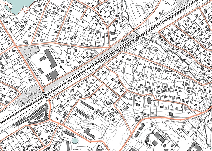

A topographic survey or topographical land survey shows the height, depth, size and location of any manmade or natural features on a given parcel of land, as well as the changes or contours in elevation throughout the parcel. While boundary surveys focus on horizontal measurements, topographic surveys are about elevation. You will also hear these surveys referred to as “topo surveys” in related industries.
Topographic Surveys: Historical Background
Topo surveys were created in series to serve as the basis for larger topographic maps. Performed on a large scale, these surveys were meant to show elevations and landforms not listed on traditional maps and surveys. The first topographic map series of an entire country is known as the Carte géométrique de la France (1789). Topographic surveys were then used for military and infrastructure-building applications. In the 1980s, databases began to replace printed topo maps. Database creators combined the information from those topo maps with other sources to create what became, by the mid-90s, user-friendly resources we now recognize when we access maps online. In present day, topographic maps still serve their purpose: assisting with geographic planning, earth science studies and civil engineering.
How A Topo Survey is Conducted
A surveying-quality global positioning system (GPS) unit and an electronic distance measurement (EDM) total station theodolite (TST) are used to determine the locations of features shown on the plan. The topography survey shows existing features, property lines, and contour lines that indicate the lay of the land
How Topo Surveys Are Used
Land survey services are asked to produce topographic surveys for:
- construction and architectural projects
- environmental restoration and property improvements
- to fulfill regulatory requirements for construction codes
- guidance for setting up grading or drainage ditches
- when land developed for one purpose is being used for another purpose
Topographical Surveys and Right of Way Acquisition
When companies begin their right of way acquisition process, they must conduct a variety of surveys, including topographic surveys. Their projects can’t be successful if the elevation and features of a parcel of land are not accounted for in the development, improvement or construction plans. While these surveys may not provide the same kind of image of a property as others, they’re irreplaceable because the details they provide can completely alter plans to build.
The Takeaway
Topographic surveys show elevation and land forms and have a myriad of practical applications. Though the number of surveys to conduct before beginning a project may be large, topography is vital and cannot be overlooked. If you’re looking to begin a project and conduct a land survey, contact us today.

